File:Thumb thumb hol sending map01.jpg
From River Twine Wiki
No higher resolution available.
Thumb_thumb_hol_sending_map01.jpg (150 × 135 pixels, file size: 40 KB, MIME type: image/jpeg)
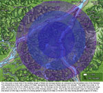
Local Map - Sending Ranges
File history
Click on a date/time to view the file as it appeared at that time.
| Date/Time | Thumbnail | Dimensions | User | Comment | |
|---|---|---|---|---|---|
| current | 11:45, 14 July 2009 | | 150 × 135 (40 KB) | HollyH (Talk | contribs) | Local Map - Sending Ranges |
- You cannot overwrite this file.
File usage
The following 2 pages link to this file: